map
*The map only displays georeferenced studies.

Nb of contributions

Nb of organisations

Nb of notebook models

Nb of datasets

Contr. type Date Authors Organisation Method Crop type Organ measured Title Soft Licence Notebook file Dimension Spatial scale Temp. scale Instrument Link (DOI) Details


Extend and select the columns thanks to the widget on the top right corner of the table. Export it using the second widget. *Table mainly build on top of the review of Zhao et al. (2019).

Project ecosystem

CAGS is an ecosystem with many interrelated projects and repositories.
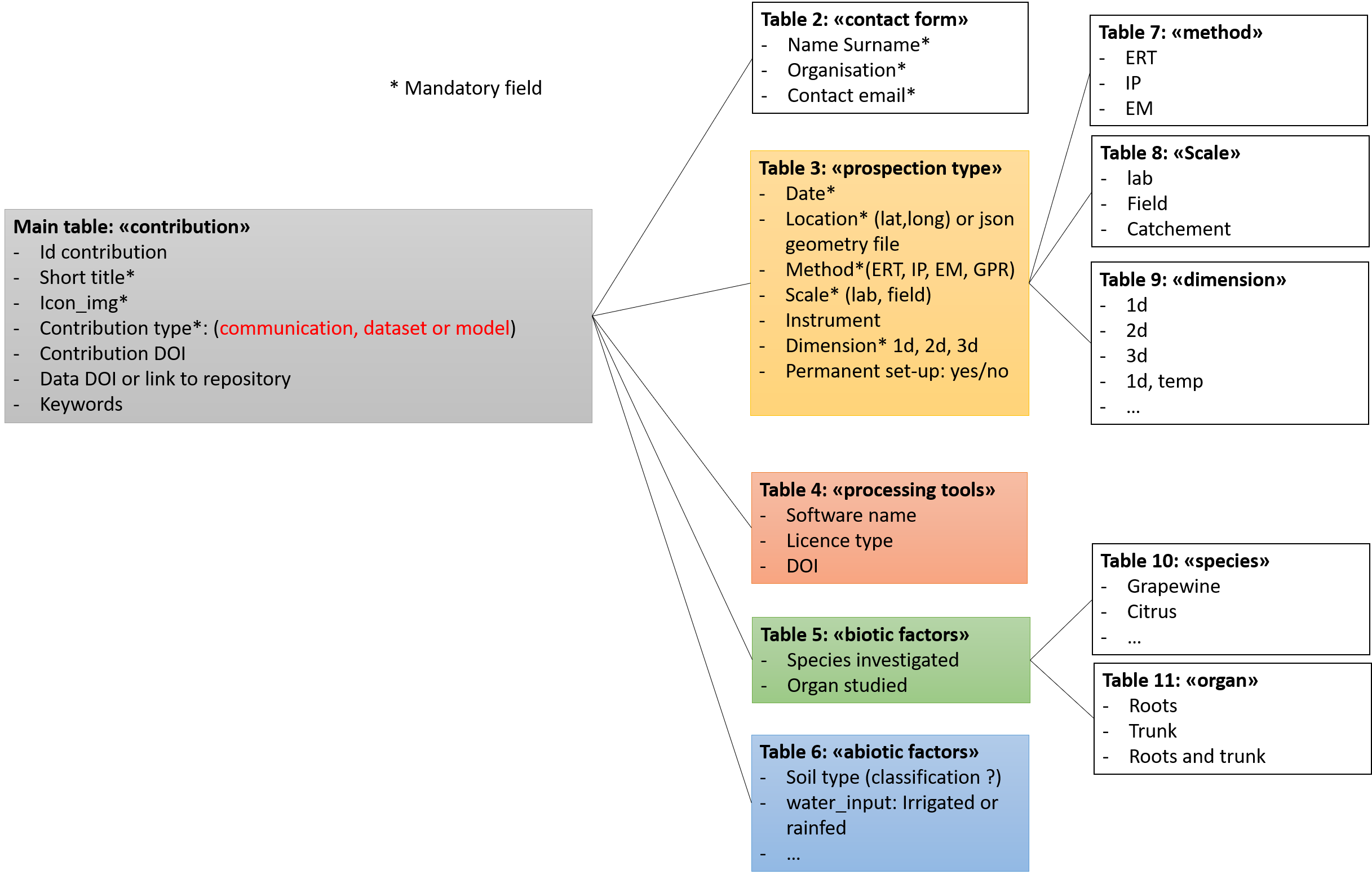
Catalog

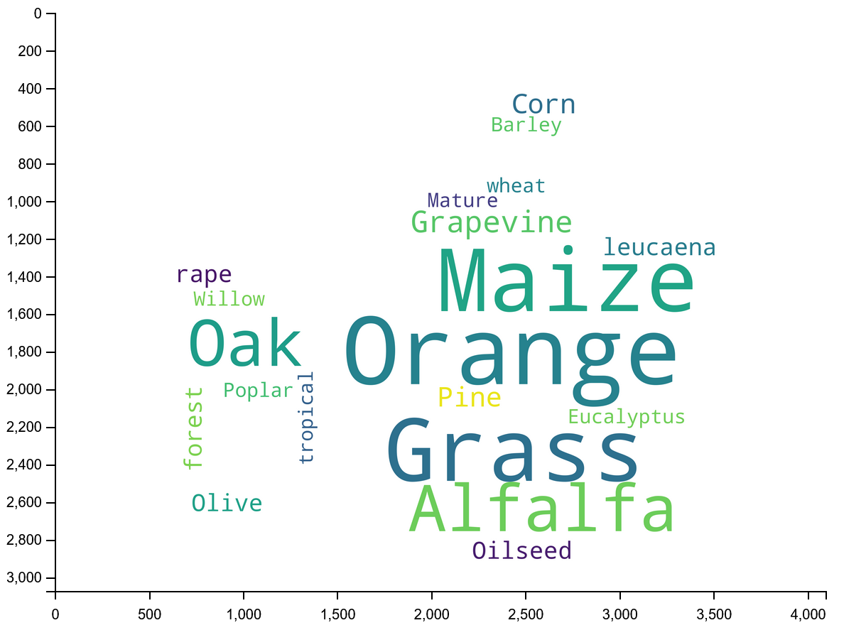
A platform putting together a database/catalog of agrogeophysical surveys in order to promote FAIR practicies and boost future research
DOI
Ready to use but changing

Notebooks

A collection of reusable jupyter notebooks that use agrogeophysical models
DOI
Ready to use but changing

Datasets

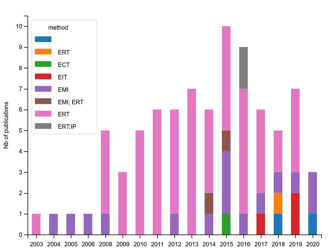
A list of agrogeophysical dataset of interest with associated survey metadata and quality assessement metadata

Skeppa

Geophysical Metadata Management
In construction

How to contribute

Accepted contributions are scientific communications with a DOI, ideally packaged with a companion computationnal notebooks and/or a dataset DOI and description complying with CAGS guidelines (see below for preparation).

Contact

Email: hello.agrogeophy@gmail.com

We welcome any feedback and ideas!

Let us know by submitting an issue on Github

Send us a message on our Slack chatroom

Objectives

  • Build a repository that is trust by the community
  • Gather datasets needed for modeling
  • Create synergies
  • Finding easily georeferenced data-sets linked to research themes

Metadata mining

Keywords cloud Keywords cloud

About the catalog

Project funding

Designed by BootstrapMade